The Legend
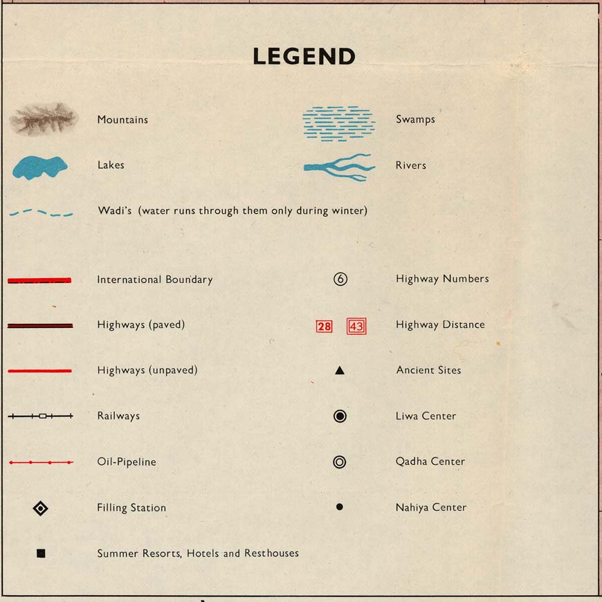
Other Symbols
Contour maps contain lots of other important information that is not always put in the legend itself. These added symbols may include a compass, which lets you know which way is north. But the important item here is the scale. This is a set of overlapping lines which tell you how far away one object will be from another. If you are ever looking at contour maps you should check this scale out. This could be the difference between gaining 5 feet in a mile, and 5 feet in a yard! And when you are hiking this is a huge difference.

The Lines
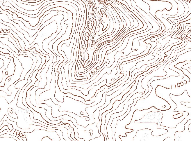
-Contour Interval: Every contour map will contain what is known as a contour interval. This number tells you (the map reader) how many feet (or meters, or kilometers) is gained or lost between the lines on the map. To save confusion and clutter on a contour map it is typical to only label some of the contour lines (like every 5th one). In this case you can simply subtract one known quantity from the other, than count the lines in between them and divide that number you found earlier by the number of lines in between.
(Given quantity A - Given quantity B)
____________________________ = Contour Interval
Number of Lines

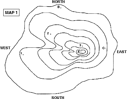
As this map shows, A would have a lower relief than B.
-Dashed Lines: When drawing a contour map it is often necessary to mark a depression in the surface. These depressions are commonly found in the World, and cannot be marked with the traditional contour line. In fact if we used a regular contour line, the depression would look like the opposite (a small hill). So to mark a depression we use little hash marks, facing in toward the center of the depression.

-Little V's: In any contour map containing streams, rivers, creeks and general water flow you will notice little
 v shaped notches in the contour lines. Although most maps will mark flowing water with a thin blue line, it is possible to find old, dried up water beds this way. If you give a little thought to the matter it would make sense as to why there are little v shaped notches in the line. A stream will cut down into the ground a bit, so when following a contour (a specific height) the line would have to go up a bit to maintain the same height as it crosses the slightly lowered terrain.
Determining Water Flow
 It is easy to say that water flows downhill, everyone knows that. But which way is downhill? Well if you read your contour lines it shouldn't be too hard to figure this out. But what if your map gets ripped, or there are no values on your lines? Well you can still figure it out by looking at the little v's I just told you about. The little v's that are present with any water flow will always point up-stream. So there you go, now you can tell which way the water is (or would be) moving.
So now if you ever get lost in the woods and have nothing but a contour map you can find your way to water (and probably food too). Also, you can tell where there will be a cliff or where the best hike might be. So go forth and conquer the world, just bring your contour map with you!
*Remember* Contour lines can never intersect, so you can make sure you aren't reading the wrong line by simply checking for intersections.
No comments:
Post a Comment